
Like many people, Julius Wagner reassessed his life during the COVID-19 pandemic and he realized his goal of starting his own business had been put on a shelf for too long.
When he sat down with his wife Sara to map out his future, it led to — map-making.
Wagner says he has a variety of interests and hobbies, and when he and his wife started talking over ideas, they made a list of possibilities based on those interests. Making maps rose to the top for a variety of reasons, including the fact that it did not require a hefty initial investment.
Bay Maps LLC was launched and today operates out of the Greater Green Bay Chamber of Commerce Startup Hub on the Northeast Wisconsin Technical College campus.
Wagner uses a desktop computer, open-source software and data sets, often from government sources, that are free to create maps.
“I’m a self-taught cartographer,” he says. “I’m constantly learning new methods and techniques.”
He also admits, “I’ve made my share of mistakes.”
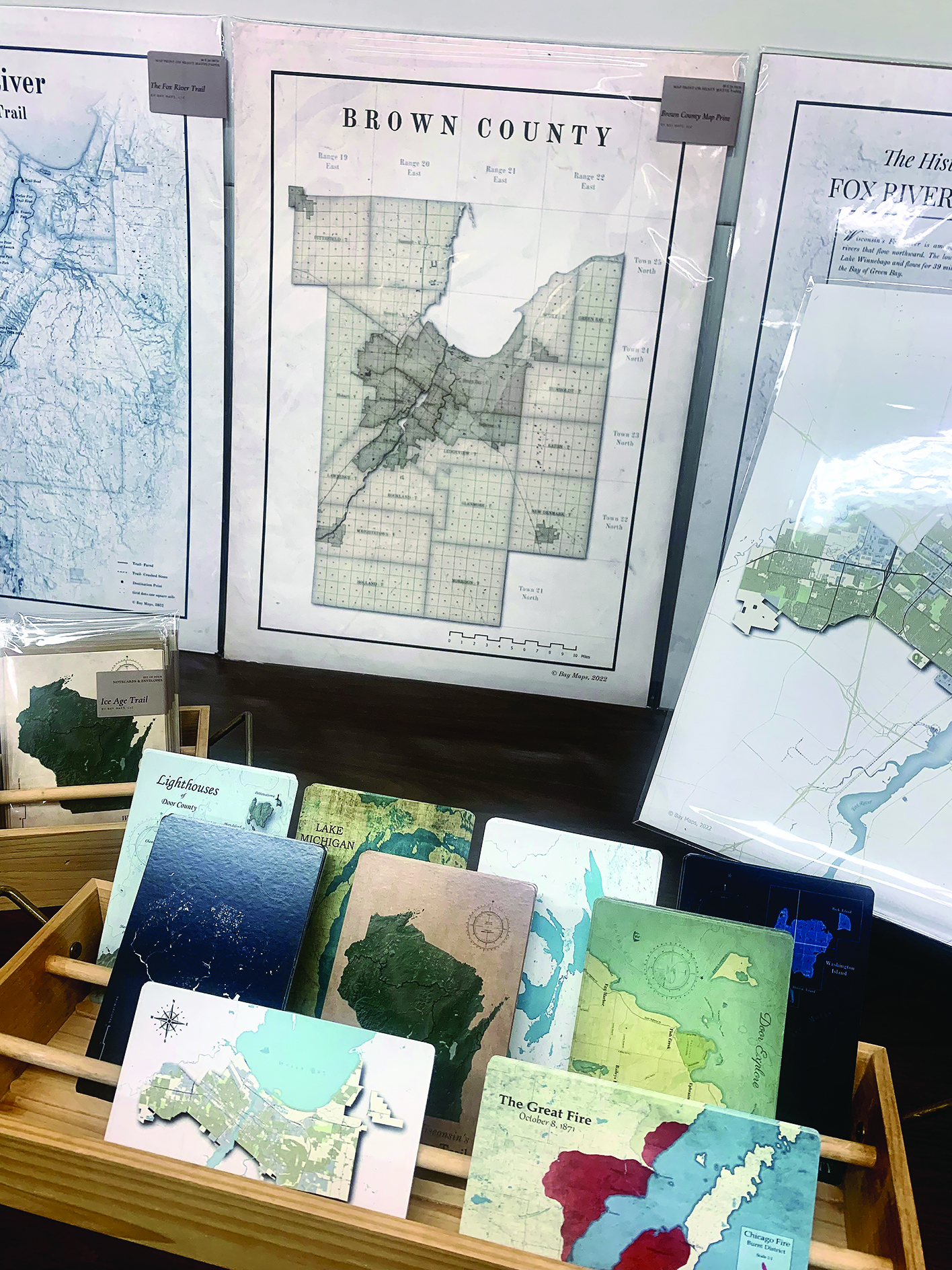
The map that started it all was based on his research about the Peshtigo Fire in October 1871. He was particularly interested in the scope of the fire compared to the Great Chicago Fire on the same date, as well as the impact the fire had on the Belgian communities in Door County.
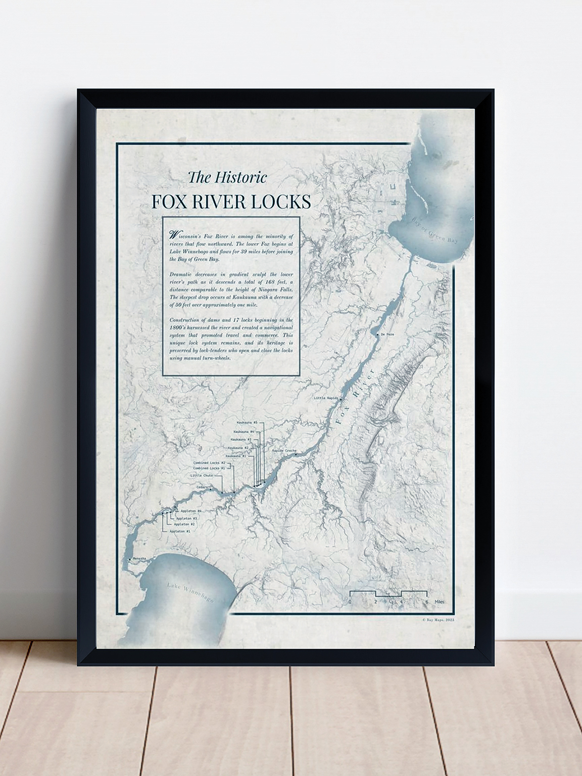
Several other of his maps have historical references or themes, such as a map of the Fox River Locks and another of the Fox River State Trail. Those three maps were selected for inclusion in the American Geographical Society Library at the University of Wisconsin-Milwaukee.
Creating maps is a bit of science and a bit of art. Wagner is learning coding to become more efficient at processing the large volumes of data he uses. But choosing and applying themes, colors and styles, he says, are what make the maps stand out.
Wagner says maps can be strictly informational, but he creates maps that offer artistic value and would be something people would want to hang on a wall.
After creating a map, Wagner sends electronic files to Green Bay Blue, which he praises for its ability to print on an eclectic variety of mediums from paper to Tyvek to aluminum to plastic. He has even designed maps printed on a magnetic, dry erase surface.
Bay Maps sells maps online and in retail outlets throughout Northeastern Wisconsin, including Green Bay, Door County, Manitowoc and Oconto. He sizes them so they can be easily framed.
The first sales for Bay Maps were at a farm market in Sturgeon Bay. It’s partly why he added smaller items such as postcards, notepads and note cards. He also has recognized that just because a map looks great, it may not be marketable.
“I knew before I started that art is very difficult to sell,” Wagner says.
But word of mouth is starting to pay dividends. Wagner sold a Fox River State Trail map to someone at the Sturgeon Bay Farm Market who turned out to have ties to the efforts to restore the trail. She invited him to participate in the effort by offering 50% of his sales from the Fox River State Trail Map to the group.
Wagner agreed and was attending a fundraiser when he met an owner from Cycling Brews, a new taphouse near the trail in De Pere. That led to a commission for a wall-size map that includes the trail as well as the locations of nearby breweries.
Wagner says he is open to designing custom maps but anticipates growth for now will be in the wholesale and retail markets of maps he designs based on his research.